
Listen to this Post
Edit
Introduction: A New Era in Understanding Extreme Weather
Every year, tropical storms unleash enormous amounts of energy across the planet, bringing destructive rainfall, severe flooding, and life-threatening weather conditions. While scientists have spent decades studying these systems, one critical mystery remains difficult to observe: how rapidly rising air currents inside storms evolve and influence their intensity.
NASA’s upcoming INCUS mission aims to change that. With three highly coordinated satellites preparing for launch, the mission represents a major leap forward in atmospheric science. Designed to observe the inner workings of tropical convective storms from space with unprecedented timing and precision, INCUS could help scientists improve weather forecasts, enhance climate research, and deepen humanity’s understanding of some of Earth’s most dynamic natural phenomena.
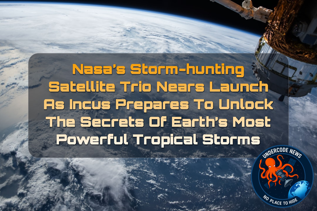
NASA’s INCUS Satellites Complete Critical Testing Phase
One of the three satellites that will form NASA’s Investigation of Convective Updrafts (INCUS) mission has successfully completed a major testing milestone at Blue Canyon Technologies in Lafayette, Colorado.
The achievement marks an important step toward launch readiness. The trio of satellites underwent extensive evaluations to ensure they can withstand the harsh conditions of space while maintaining precise operational coordination throughout the mission.
As preparations continue, NASA and its partners are moving closer to a mission that could redefine how scientists monitor tropical storm development from orbit.
Three Satellites Working as One Scientific Instrument
Unlike traditional Earth-observation missions that rely on a single spacecraft, INCUS employs a fleet of three nearly identical satellites flying in carefully synchronized formation.
The orbital choreography is remarkably precise. The first and second satellites will be separated by only 30 seconds, while the second and third satellites will maintain a 90-second interval. This tight formation allows researchers to capture rapid changes occurring within storms as they evolve.
Rather than observing a weather system at one moment in time, the mission will effectively create a time-lapse view of atmospheric processes unfolding over minutes. This capability is expected to provide scientists with a far more detailed understanding of storm growth and behavior.
The Science Behind Convective Mass Flux
At the heart of the mission lies a sophisticated scientific objective: measuring convective mass flux.
Convective mass flux refers to the vertical movement of air and water inside developing storm systems. These powerful upward currents serve as the engine that drives thunderstorm formation and tropical weather intensification.
Understanding how these updrafts strengthen, weaken, and interact with surrounding atmospheric conditions is crucial for improving predictive weather models.
Each INCUS satellite carries specialized radar technology capable of tracking these vertical motions. Meanwhile, the middle spacecraft includes an additional microwave radiometer that will gather complementary atmospheric data.
Together, these instruments will create one of the most detailed datasets ever collected on tropical convective processes.
Why Tropical Storm Research Matters More Than Ever
The importance of studying tropical convection extends far beyond academic research.
Extreme rainfall events are becoming an increasingly significant concern for communities worldwide. Accurate forecasting remains one of the greatest challenges in meteorology because storm intensification can occur rapidly and sometimes unexpectedly.
By observing the mechanisms driving these weather systems, INCUS could contribute to:
Improved severe weather forecasting.
Better flood prediction capabilities.
Enhanced climate modeling accuracy.
More reliable hurricane and tropical storm intensity assessments.
Greater understanding of precipitation patterns in a changing climate.
The
Launch Scheduled from Historic Wallops Facility
NASA plans to launch the INCUS mission in 2027 from the Wallops Flight Facility in Virginia.
Wallops has become an increasingly important launch site for scientific missions focused on Earth observation and atmospheric research. The facility provides an ideal location for deploying spacecraft dedicated to studying our planet’s complex environmental systems.
Once operational, the satellites will enter low Earth orbit and begin collecting data on tropical storm systems around the globe.
Part of NASA’s Larger Earth System Observatory Vision
INCUS is not an isolated project. It forms part of NASA’s broader Earth System Observatory initiative, an interconnected collection of missions designed to study Earth’s atmosphere, oceans, land surfaces, ice systems, and climate interactions.
The mission was selected through the Earth Venture Mission-3 program under NASA’s Earth System Science Pathfinder framework.
Led by principal investigator Sue van den Heever of Colorado State University, the project demonstrates how universities, government agencies, and private aerospace companies can collaborate to tackle some of the most challenging scientific questions facing humanity.
Through this integrated approach, NASA hopes to develop a more comprehensive understanding of Earth’s interconnected environmental systems.
FALCON: A New Generation of Collaborative Space Science
INCUS also contributes to FALCON, the Fleet for the Atmosphere Linking Commercial Observations with NASA.
This initiative represents a modern approach to space exploration, combining expertise and hardware from NASA centers, universities, and commercial aerospace partners.
Rather than relying exclusively on large flagship missions, FALCON embraces distributed satellite networks capable of delivering high-frequency observations at lower cost and with greater operational flexibility.
Such partnerships are increasingly shaping the future of Earth science and space-based environmental monitoring.
Deep Analysis: How INCUS Could Transform Atmospheric Science
The true significance of INCUS extends beyond its hardware specifications.
For decades, atmospheric scientists have struggled with one persistent challenge: capturing the rapid evolution of convective storms. Traditional satellites often revisit the same storm after lengthy intervals, leaving critical moments of storm development unobserved.
INCUS directly addresses this observational gap.
By deploying three coordinated satellites in close formation, NASA effectively creates a dynamic observational platform capable of tracking atmospheric changes in near real time. This approach resembles a distributed sensor network rather than a conventional satellite mission.
From a data-processing perspective, the mission will generate enormous volumes of atmospheric measurements that can be integrated into numerical weather prediction models. Advanced computing systems and machine-learning algorithms may eventually use INCUS datasets to identify patterns associated with rapid storm intensification.
For researchers working with atmospheric datasets, analysis environments may include tools such as:
Access atmospheric datasets
wget storm-data-source
Process radar observations
python analyze_convective_flux.py
Visualize storm evolution
jupyter notebook
Large-scale climate model integration
python assimilate_incus_data.py
Linux-based scientific workflows
grep "updraft" storm_observations.log
The mission also highlights an important trend in space science: moving away from single-spacecraft dependency toward coordinated satellite constellations. Future Earth-observation missions may increasingly adopt this architecture because it offers higher temporal resolution and improved resilience.
Most importantly, INCUS bridges the gap between weather forecasting and climate science. The same convective processes responsible for individual storms also influence long-term climate behavior. Understanding one helps improve understanding of the other.
As climate variability continues to challenge forecasting systems worldwide, missions like INCUS may become essential components of the next generation of atmospheric monitoring infrastructure.
What Undercode Say:
NASA’s INCUS mission is much more significant than its modest size initially suggests.
The mission demonstrates how scientific innovation is increasingly driven by smarter observation strategies rather than simply larger spacecraft.
Three satellites flying in formation may appear straightforward on paper, but the scientific value lies in their synchronized timing.
Capturing a storm every few seconds instead of every several minutes fundamentally changes what researchers can observe.
Weather systems evolve rapidly.
Many forecasting errors originate from insufficient observations during critical developmental stages.
INCUS directly targets this weakness.
The mission effectively transforms space-based weather monitoring into a high-speed observational system.
Another notable aspect is the use of specialized radar technology focused on vertical air movement.
Many existing observation platforms emphasize cloud structures or precipitation rates.
INCUS instead examines the atmospheric engine driving storm formation.
This provides a deeper layer of understanding.
The inclusion of a microwave radiometer further strengthens the mission’s scientific capabilities.
Combining multiple observation methods increases data reliability and analytical value.
The mission also reflects
Distributed satellite fleets are becoming increasingly attractive.
They provide flexibility.
They reduce mission risk.
They often cost less than large standalone platforms.
FALCON’s collaborative framework may serve as a model for future Earth science initiatives.
Partnerships between universities, government agencies, and commercial companies are accelerating innovation.
INCUS is an example of this trend in action.
From a climate perspective, the mission could become exceptionally important.
Convective storms play a central role in global energy transfer.
They influence rainfall patterns.
They affect atmospheric circulation.
They impact regional climate systems.
Better observations can lead to better climate projections.
Improved projections support better policy decisions.
The
Its datasets may become reference material for future atmospheric studies.
Researchers worldwide will likely use INCUS observations long after the primary mission concludes.
The project represents a strategic investment in knowledge rather than infrastructure alone.
That distinction matters.
In modern Earth science, better data often produces greater breakthroughs than bigger satellites.
INCUS embodies that philosophy perfectly.
✅ NASA’s INCUS mission consists of three coordinated satellites designed to study tropical convective storms.
✅ Each satellite carries radar instruments intended to observe convective mass flux, while the middle satellite also includes a microwave radiometer.
✅ The mission is scheduled for launch in 2027 from NASA’s Wallops Flight Facility and operates under NASA’s Earth System Science Pathfinder framework.
Analysis
✅ The article accurately reflects the
✅ The described satellite separation intervals align with publicly released mission details.
✅ References to Earth System Observatory and FALCON participation are consistent with NASA’s stated program goals.
Prediction
(+1) Greater Forecast Accuracy 🌎📡
INCUS data could significantly improve short-term storm prediction models, leading to more accurate rainfall and severe weather forecasts across tropical regions.
(+1) Expansion of Satellite Constellation Science 🚀
The mission may encourage future Earth-observation programs to adopt coordinated multi-satellite architectures instead of relying solely on large individual spacecraft.
(+1) Stronger Climate Research Capabilities 📊
High-resolution measurements of convective activity could improve climate simulations and help scientists better understand precipitation changes in a warming world.
(-1) Data Integration Challenges ⚠️
The enormous volume of atmospheric measurements may require substantial computational resources and new analytical methods before their full scientific value can be realized.
(-1) Operational Coordination Risks 🛰️
Maintaining precise formation flying among three satellites over long periods presents technical challenges that could affect observation schedules if anomalies occur.
🕵️📝Let’s dive deep and fact‑check.
🎓 Live Courses & Certifications:
Join Undercode Academy for Verified Certifications
🚀 Request a Custom Project:
Secure, high-velocity infrastructure and disruptive technological engineering. Contact our engineering team for high-tier development and proprietary systems:
[email protected]
💎 Smart Architecture | 🛡️ Secure by Design | ⭐ Trusted by Thousands
References:
Reported By: science.nasa.gov
Extra Source Hub (Possible Sources for article):
https://www.twitter.com
Wikipedia
OpenAi & Undercode AI
Image Source:
Unsplash
Undercode AI DI v2
🔐JOIN OUR CYBER WORLD [ CVE News • HackMonitor • UndercodeNews ]
📢 Follow UndercodeNews & Stay Tuned:
𝕏 formerly Twitter 🐦 | @ Threads | 🔗 Linkedin | 🦋BlueSky | 🐘Mastodon | 📺Youtube


