
Listen to this Post
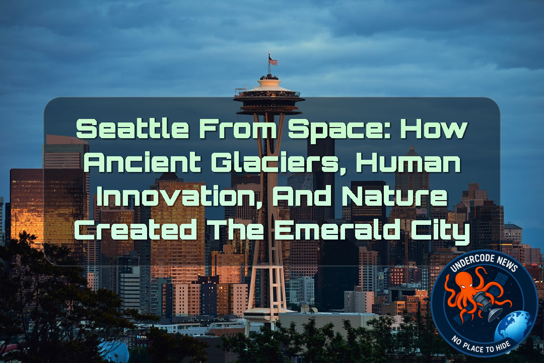 Introduction: A City Written by Ice and Rebuilt by Humans
From the window of the International Space Station, Seattle appears like a living painting — a city where deep green forests meet blue waterways, modern skyscrapers rise beside historic neighborhoods, and human engineering blends with landscapes shaped by forces far older than civilization itself.
Known around the world as the “Emerald City,” Seattle’s identity is not only connected to its technology companies, cultural influence, and urban growth. Its unique appearance comes from a geological story stretching back thousands of years, when enormous glaciers carved valleys, created lakes, and shaped the hills that define the city today.
A remarkable astronaut photograph captured on June 16, 2026, reveals Seattle from an extraordinary perspective. From orbit, the city’s relationship with nature becomes clearer: the waterways, hills, forests, ports, and neighborhoods form a complex pattern created by both ancient ice movements and centuries of human transformation.
This image is more than a beautiful view of a major American city. It is a reminder that every modern landscape carries a hidden history — one written by glaciers, rivers, engineering projects, and generations of people adapting to their environment.
Astronaut View Reveals Seattle’s Hidden Geographic Story
An astronaut aboard the International Space Station captured a stunning image of Seattle while orbiting hundreds of kilometers above Earth. The photograph shows downtown buildings casting long shadows, ships moving through surrounding waterways, and green spaces spreading throughout the metropolitan area.
From the ground, Seattle’s landscape can seem ordinary: steep streets, waterfront neighborhoods, lakes, and hills. However, from space, the deeper structure of the region becomes visible. The city sits within a landscape heavily influenced by geological forces that operated thousands of years before humans arrived.
The photograph provides scientists and the public with a unique perspective of how natural systems and urban development interact. It highlights the balance between preserving natural environments and expanding a growing city.
The Ice Age Created the Foundation of Modern Seattle
Seattle’s modern geography was largely created during the last ice age when massive glaciers covered much of the Pacific Northwest.
Approximately 18,000 to 16,000 years ago, the Puget lobe of the Cordilleran ice sheet moved across the region. This enormous glacier reached thicknesses of nearly 3,300 feet (1,000 meters), placing unimaginable pressure on the land below.
As the glacier advanced and retreated, it carved deep basins that eventually became major waterways, including parts of Puget Sound and several regional lakes.
The smooth valleys, steep hills, and waterways visible today are not random features. They are the scars left behind by one of the most powerful natural forces on Earth.
Seattle is, in many ways, a city built on the remains of an ancient frozen landscape.
Seattle’s Famous Hills Are Remnants of Glacial Movement
One of Seattle’s most recognizable characteristics is its uneven terrain. Residents often joke about the city’s endless hills, with some counting seven major hills and others identifying even more.
Many of these hills are actually drumlins — elongated hills formed by glaciers pushing and depositing layers of rock, sand, and soil.
These formations generally run north to south, following the direction of ancient glacier movement. This explains why traveling east and west across Seattle often means navigating steep climbs and descents.
The city’s challenging streets are not simply the result of urban planning. They are geological reminders of a time when a giant sheet of ice controlled the shape of the region.
The Giant Rocks Left Behind by Ancient Ice
The glaciers that shaped Seattle also transported enormous rocks from distant northern areas.
These large stones, known as glacial erratics, were carried hundreds of miles before being abandoned as the ice melted.
One famous example is Wedgwood Rock, a massive boulder standing approximately 20 feet (6 meters) tall in North Seattle. The rock represents a geological journey that began far from its current location.
Today, these stones serve as natural monuments, preserving evidence of the powerful movements that transformed the Pacific Northwest.
Humans Reshaped Seattle’s Natural Landscape
While glaciers created Seattle’s foundation, humans have dramatically modified the landscape over the past century.
One of the most significant transformations was the removal of Denny Hill, a large hill north of downtown. Engineers flattened the area to support urban expansion and improve transportation.
Another major project involved filling tidal flats near the mouth of the Duwamish River. This created approximately 1,300 acres of new land, allowing Seattle to expand its industrial areas and infrastructure.
Today, some of Seattle’s major sports stadiums sit on land that did not exist in its current form before these engineering projects.
The city demonstrates how human innovation can reshape geography on a massive scale.
The Waterfront Transformation Changed Seattle’s Relationship With Water
The astronaut image was captured after major waterfront redevelopment projects were completed.
Beginning in 2010, Seattle launched extensive improvements to modernize its downtown waterfront. These projects included:
A redesigned ferry terminal
A stronger seawall
Improved public waterfront spaces
Replacement of an elevated highway with an underground tunnel
These changes transformed the waterfront from a transportation corridor into a more accessible public area.
The redevelopment also reflected a broader global trend: cities are increasingly redesigning coastal areas to improve resilience against climate change, rising sea levels, and population growth.
Engineering Connected Seattle’s Lakes and Ocean
Seattle’s waterways were also heavily modified through major engineering projects in the early 20th century.
During the 1910s, the U.S. Army Corps of Engineers constructed canals connecting Lake Washington, Lake Union, and Puget Sound.
The Montlake Cut, completed in 1916, created a direct connection between Lake Washington and Lake Union.
The Ballard Locks later allowed boats to travel between freshwater lakes and the tidal waters of Puget Sound.
These projects changed the region permanently. Lake Washington’s water level dropped by approximately 9 feet (3 meters), and its natural southern outlet stopped functioning as its main drainage route.
The modern Seattle maritime system exists because of these ambitious engineering decisions made more than a century ago.
Seattle Today: A City Where Nature Still Survives
Despite decades of urban growth, Seattle remains deeply connected to nature.
The city still contains pockets of old-growth forest featuring ancient trees such as:
Douglas fir
Western red cedar
Western hemlock
These forests contribute to Seattle’s “Emerald City” identity and provide habitats for wildlife.
Residents regularly encounter bald eagles, coyotes, sea lions, and other species living alongside one of America’s fastest-growing urban areas.
Seattle’s story is not about replacing nature with cities. It is about a continuous negotiation between human development and environmental preservation.
Deep Analysis: The Science, Technology, and Meaning Behind Seattle’s Space Image
The astronaut photograph of Seattle represents far more than a high-resolution image from orbit. It is a scientific record showing how Earth systems interact over different timescales.
Ancient glaciers operated over thousands of years, slowly carving the terrain.
Human engineering projects transformed the same landscape within decades.
Modern satellite and astronaut photography allow researchers to observe these changes from a completely different perspective.
The image demonstrates how geography influences civilization.
Seattle’s ports exist because glaciers created navigable waterways.
Its neighborhoods developed because humans adapted hills and shorelines.
Its transportation networks exist because engineers modified natural barriers.
The relationship between geology and society is visible everywhere in the photograph.
Scientists can use orbital imagery to study:
Urban expansion
Coastal changes
Environmental protection
Water management
Climate impacts
Infrastructure development
The photograph also highlights an important lesson about sustainable cities.
Seattle benefits from its natural environment but also faces challenges caused by population growth and climate change.
Coastal cities worldwide must rethink how they interact with oceans, rivers, and ecosystems.
Modern engineering cannot ignore natural systems.
Instead, future development must work with geological realities.
Seattle’s history provides a valuable example:
Glaciers created the landscape.
Humans modified the landscape.
Future generations must protect the landscape.
The city’s success depends on maintaining balance.
The image also shows how technology has transformed our understanding of Earth.
An astronaut with a digital camera can capture information useful to scientists studying environmental change.
Space-based observations are becoming increasingly important for monitoring:
Urban heat patterns
Forest health
Water resources
Disaster risks
Climate adaptation
Seattle’s photograph is therefore both artistic and scientific.
It captures a city shaped by ice, transformed by humans, and observed from space.
What Undercode Say:
Seattle’s astronaut photograph represents one of the most powerful examples of how technology reveals hidden stories about our planet.
At first glance, the image looks like a simple city photograph. However, behind the buildings and waterways exists a 20,000-year geological timeline.
The most interesting aspect of Seattle is that its identity comes from a combination of destruction and creation.
The glaciers destroyed existing landscapes but created the foundation for one of America’s most important cities.
Human beings then continued the transformation process by reshaping shorelines, redirecting waterways, and building infrastructure.
This creates an important question: Are humans changing nature too aggressively, or are we simply continuing the process of adaptation?
The answer is complicated.
Seattle demonstrates that humans can successfully modify landscapes, but every modification creates new responsibilities.
The waterfront redevelopment project shows a modern approach where cities are not only expanding but also attempting to restore public connections with nature.
The future of urban development will likely depend on this balance.
Cities cannot completely control natural forces.
Climate change, rising oceans, extreme weather, and ecological pressures will continue challenging urban environments.
The lesson from Seattle is that successful cities must understand their geological foundations.
A city built without respecting geography will eventually face serious problems.
A city that studies and adapts to its environment can become stronger.
Seattle’s combination of forests, technology, maritime infrastructure, and scientific research makes it a model for future urban planning.
The photograph from space reminds humanity that every city is part of a much larger Earth system.
Buildings may last decades.
Infrastructure may last centuries.
But geological forces operate across thousands or millions of years.
Understanding that timeline is essential for building sustainable communities.
Seattle is not simply a city surrounded by nature.
Seattle is a city created by nature.
✅ Verified: Seattle’s landscape was heavily shaped by glaciers
Scientific research confirms that the Puget lobe of the Cordilleran ice sheet dramatically influenced the region’s geography during the last ice age. The glaciers created many of the valleys, hills, and waterways that define modern Seattle.
✅ Verified: Seattle’s waterways were modified by human engineering
Historical records confirm that projects such as the Lake Washington Ship Canal, Montlake Cut, and Ballard Locks permanently changed regional water movement and connected freshwater lakes with Puget Sound.
✅ Verified: Astronaut photography contributes to Earth science research
NASA’s Crew Earth Observations program provides astronaut images used by scientists, educators, and researchers to study Earth systems, environmental changes, and human impacts.
Prediction
(+1) Seattle will continue becoming a global example of climate-aware urban development
As coastal cities face increasing environmental challenges, Seattle’s combination of infrastructure investment, green spaces, and scientific research may influence future urban planning models worldwide.
(+1) Space-based observation will become more important for city management
Future cities will increasingly depend on satellite and astronaut imagery to monitor climate risks, urban expansion, and environmental changes in real time.
(-1) Urban growth may put pressure on Seattle’s natural ecosystems
Population increases and infrastructure demands could threaten forests, waterways, and wildlife habitats if development is not carefully managed.
(-1) Climate change remains a major challenge for Seattle’s future
Rising sea levels, extreme weather events, and ecosystem changes could test the city’s ability to protect its waterfront and natural resources.
(+1) Seattle’s geological history will continue attracting scientific interest
The city’s unique combination of glacial history, engineering achievements, and environmental adaptation makes it an important case study for understanding how humans live within changing landscapes.
▶️ Related Video (80% Match):
🕵️📝Let’s dive deep and fact‑check.
🎓 Live Courses & Certifications:
Join Undercode Academy for Verified Certifications
🚀 Request a Custom Project:
Secure, high-velocity infrastructure and disruptive technological engineering. Contact our engineering team for high-tier development and proprietary systems:
[email protected]
💎 Smart Architecture | 🛡️ Secure by Design | ⭐ Trusted by Thousands
References:
Reported By: science.nasa.gov
Extra Source Hub (Possible Sources for article):
https://www.pinterest.com
Wikipedia
OpenAi & Undercode AI
Image Source:
Unsplash
Undercode AI DI v2
🔐JOIN OUR CYBER WORLD [ CVE News • HackMonitor • UndercodeNews ]
📢 Follow UndercodeNews & Stay Tuned:
𝕏 formerly Twitter 🐦 | @ Threads | 🔗 Linkedin | 🦋BlueSky | 🐘Mastodon | 📺Youtube


